Journey to Manali and around Sightseeing
This route is one of the most scenic of entire Ladakh. Beauty of this it is completely different over Srinagar Leh road.
Leh
An altitude of 11483 ft., Leh, your dream comes true on reaching Ladakh, and the excitement to reach Leh will refresh each of your body parts even after these around 12 hours of an arduous journey on the Srinagar Leh / Manali Leh Highway in a single day. But it is also nostalgic to leave Leh city for further your journey to Manali or Srinagar.
It’s always better to spend a couple of nights at Leh for local sightseeing and get a feel of the culture, people, traditions, monasteries and magical aura of Leh-Ladakh. It will also help you accutome to further sightseeing places in Ladakh.
Main market and Changspa road are two happening places in Leh. So, if you like a lively environment, then try to take a hotel to stay in Leh as close to them as possible. The next day, along with local sightseeing, you can also arrange the Inner Line Permits for other Ladakh destinations you are planning to visit in Leh-Ladakh.
Upshi
It is an altitude of 11418 ft. Upshi has the first police check-point where you need to register your details like name along with vehicle number in the records. Foreigners are requested for passports veriication at Upshi police checkpoint. This destination marks either your departure from Leh town or your arrival in Leh town.
Upshi is a small village from where the right will take you to Hanle and Tso Moriri lake via Chumathang. It does have few very basic home stays / guest houses with food.
A few km earlier from Leh to Upshi, at Karu, you will finally find the first petrol pump of Leh-Manali Highway. You should top up at Karu petrol pump when traveling from Leh to Tso Moriri to Manali or in your preferred destination without going back to Leh. But, you can ignore it if you travelling from Manali or any other place to Leh town, as there are lots of options are available.
Rumste
An altitude of 13977 ft. When you travel from Leh, Rumste is the last settlement you will come across as you are leaving the Leh Valley. It is situated alongside the Indus river and has some tea houses and home stays.
The road conditions are in good shape at Rumtse. From Leh to Pang, the road conditions are excellent, not only that mostly on Leh-Manali highway. But exceptions always has to be considered. There will be a point when you are driving just beside the Indus river and definitely you will feel ecstatic, forgetting all about the swaying headaches in the past 3-4 hours.
When you travel from Manali then, after reaching Rumtse, you will start to breathe a bit better, and so as your head will also feel slightly lighter due to the decrease in altitude. But when you travel from Leh to Manali then you may feel some problem due to hike of altitude.
There might be no options for accommodation at Rumste apart from some home stays if the villagers allow you to stay. Secondly, the drive from Leh to Rumste is almost like driving in plains, and you can cover the remaining distance fast enough.
Hence, after clicking the pictures of this small village or spending time beside the Indus river, you better move ahead towards Manali / Leh.
Taglang La or Tanglang La
An altitude of 17481 ft. Taglang La is the first and the highest mountain pass on Leh-Manali highway and fifth on the way from Manali to Leh road trip.
This pass is also the falsely claimed to be World Second Highest Motorable Road, after Khardung La (18379 feet) which is also falsely claimed as World Highest Motorable Road.
The winds at the Tanglang La pass are cold and the force is such that it will blow you off the cliffs. Sometimes, it’s even hard to stand on your ground even. Secondly, the oxygen level per breath decreases considerably and with almost nil vegetation, most people suffer breathlessness at this pass.
The raging pollution from trucks or oil tankers also accounts for the stoppage being brief, by most people. Don’t be surprised if your head may also spin many rounds at this place, especially when you travel to Ladakh from Manali side. It is not recommended to spending more than 15 minutes on Taglang La pass.
Debring,
An altitude of 15863 ft. At Debring, there are few wrecked shelters of road workers may be and some army camps too. Sometimes there you can find a make shift dhaba too where you can stop for tea.
Debring is the point where the diversion road to Tso Kar and Tso Moriri lakes connect at Leh Manali Highway. The road is a mix of good and bad to Tso Moriri from Debring.
However, you should not visit the Tso Moriri lake from Manali side as you will not do not have the inner line permits to visit the lakes. If you are traveling from Manali to Leh by car, even if you arrange the permits through a travel agent, it is not recommended that you attempt a stay at such high altitudes (Tso Moriri 15075 ft and Tso Kar 14863 ft) without proper acclimatization.
Well, on your return journey from Leh to Manali, if you have plans to visit Tso Moriri and Tso Kar lakes then you can exit on Manali Leh Highway at Debring via this route.
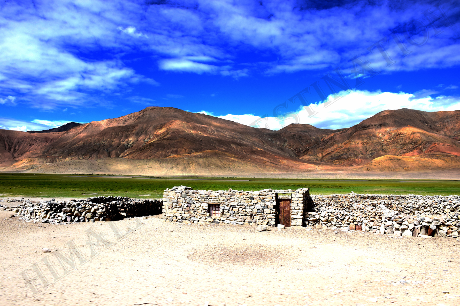
Moore Plains or More Plains or Morey Plains
An altitude of 15518 ft. Next place in the Leh-Manali highway is one of the most compelling and popular by the names More Plains or Moore plains, or Morey plains.
More plains are surprising, flat bedded plains amidst the highest of hills in the country, over a length of around 35 km. As soon as one reaches Moore Plains, the instincts force people to make their roads but it is advisable to you not to do so because it damages the ecology of the place and disturbs the wildlife. So, please stay on that beautiful blacktop road.
Thanks to BRO, for prepare such type of smooth and tarmac road in this high altitude. It is requested to all tourist, do not drive off-road or try to shortcut, it will damage our eco-system. Many of the wild animals live on the water sources present in Moore plains and running the car off the roads may damage those scarce sources. Many people try to do off-road for show off, and all sought of things with their vehicles, including the race with other fellow drivers. However, these jerks are unaware of the fact that along with risking the damage to the vehicle in loose soil or potholes in the middle of nowhere, they are also disturbing the ecology of the place. It is our responsibility to keep the nature calm, clean and maintain our eco system as nature want.
Be ready with your camera to capture Kiangs (Ladakh wild asses) and Blue Sheep too at Moore Plains on Leh-Manali Highway. but it is completely depends upon your luck.
Pang
It is at an altitude of 15092 ft, where you can view those unique looking soil formations on the mountains. The special and deserted colors of Ladakh will become lost after Pang and towards Manali. Pang also has the World’s Highest Transit Camps.
At Pang, there are available few tented accommodations in Dhabas for a night stay and one can also enjoy food or beverages on their short stopover at Pang.
Few km after Pang towards Manali, the road runs alongside a river which offers an exciting feeling and some very nice views. Pang, along with its surrounding areas, does offers some fantastic views to be captured in your camera. Hence, do not miss the opportunity to record a few live drive experience in between Pang and Sarchu.
Pang is at a higher altitude than Sarchu, which will account for headaches and Mountain Sickness and offers much lesser accommodation options too. Hence, it is recommended to avoid night stay at Pang. But you can stay at Sarchu, which offers Swiss tents too unless you have some emergency.
You may get some fuel or petrol in black in Dhabas at Pang in case of an emergency.
Pang is an important place where you can find food and accommodation at least before Keylong (few small dhabas are available en-route of journey).
If you are coming from Manali / Leh and running late, then at Rumtse & Upshi (next option of Pang, if you coming from Manali) and Sarchu & Keylong (next option of Pang, if you coming from Leh) as well you are likely to be unlucky on the accommodation front. Hence, if you think you have gone late and don’t want to carry on till Keylong / Sarchu / Leh in the dark, then it is recomended to you stay at Pang only and thoroughly enjoy the rest of the colorful journey in the next day’s daylight. It will be worthy to you.
Some of the dhaba have electricity arranged from transit camps or battery backups, or solar panel, so, you may charge your phone or camera here. Also, the army transit camp may have a phone to call back home in case of an emergency.
In case of any medical emergency on Leh-Manali Highway, you can get help at the Pang army transit camp.
Lachalung La or Lachulung La
At an altitude of 16616 ft, is the Second Highest Pass on the Leh-Manali Highway and second on the way from Leh Manali road trip.
Get ready to start feeling some more breathlessness from here on. You will reach above an altitude of 16000 feet for the first time on your journey from Manali to Leh (if you are coming from Manali side). Naturally there is no options available for fuel, food or accommodation at Lachulung La pass.
Nakee La
It is at an altitude of 15547 ft, the third pass from both side (travel drom Leh to Manali or travel from Manali to Leh) on the Leh-Manali Highway on your Leh Manali road trip. You will not find any soul, food, accommodation or fuel, or even trees here. The place is deserted.
There are few short cuts around Nakee La of dirt roads, it is strongly advise not to take any of the short cuts because, many cars losing control especially when getting down and losing tractions or burning brakes.
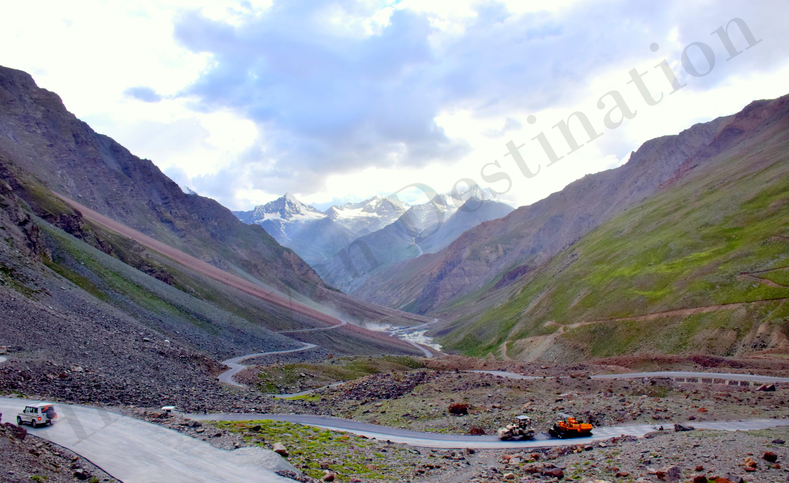
Gata Loops
An altitude of 13747 ft, just after Nokee La Pass, with 21 hairpin bends or loops, around 7 km long stretches will takes you from 15190 ft to 13747 ft. Sarchu is around 24 km from here. These loops are famously called Gata Loops. There is no options of food and accommodation here.
Please note that there goes a story of a ghost of the Gata loops, please don’t pollute the environment in the name of the ghosts or superstitions and do not throw plastic bottles in the offering to them. Even if you are superstitious, offer the water and keep the bottle with yourself.
Sarchu
At an altitude of 14075 ft. From Sarchu Manali is around 222 km, is famous for the night halt because it offers some good tented accommodations on the Leh-Manali Highway. At Sarchu, you have entering another state called Himachal Pradesh. Also, at Sarchu The Project Himank ends and The Project Deepak start.
At Sarchu, there is a second police checkpoint where you need to register your name again on this epic journey on Leh-Manali or Manali-Leh Highway. The entry acts as a record of your arrival up to Sarchu.
Sarchu is almost a middle point of the journey on Leh-Manali highway offering some good accommodation options including the Swiss tents with attached toilets. Hence, many people do consider Sarchu for a night halt. People already having the night halt at Keylong or Jispa, usually stops for lunch at Sarchu. It does have a few Dhabas which offer food and beverages as well. Dhaba may not available all time, so taking lunch is depends on dhaba’s availability.
At Sarchu, you may get some fuel or petrol in black in dhabas in case of any emergency.
Advice to avoid night stay at Sarchu when you coming from Manali
Sarchu is at very high altitude and many people staying overnight at this rough place suffer from Altitude Mountain Sickness including sleepless nights, severe headaches or vomiting. Many traveler called Sarchu as Vomit Hilton.
If you are not properly acclimatized, you will surely be one of them, suffering the pinch or punches, especially at night. While traveling from the Manali side, the body does not acclimatize properly and in case you have not had a night stay at Keylong or Jispa, your body will be or may be suffer to adapt at such a high altitude of Sarchu at night.
Hence, even though Sarchu offers some good amount of stay options (tented) but it’s always better to avoid a stay at Sarchu over Jispa or Keylong in the same order of preference. However, if you are coming from Leh or Tso Moriri lake after spending a few nights at higher altitudes in Ladakh, then your body is properly acclimatized already. So, in that case, you can choose to stay at Sarchu to break the journey on Manali Leh Highway evenly.
Bharatpur (Kaylong Sarai / Sarchu Sarai)
At an altitude of 15092 ft. In Bharatpur has a few Dhabas to have some food as well as a series of tented accommodation running road side of the Leh-Manali Highway.
Some people do stay overnight at these camps as well, but being in much higher altitude than Sarchu, it is not recommended to sleep at Bharatpur as well. The accommodation or camps at Bharatpur are cheaper as compared to the stay options at Sarchu. After crossing Bharatpur, you have to pass through a small deserted place named Kaylong Sarai or Sarchu Sarai towards Manali.
Once you cross Sarchu, after a few km, you will come across a road straight as an arrow leading towards Bharatpur. Your instincts will induce you to a break and just zip pass through it, especially after you have been held up by the road conditions since morning.
It will not suggested and not recommended to hold on to those instincts of pushing the accelerator of your as the road is straight, rather carpeted. Still, it does have lots of bumps (may be due to the loose soil beneath or due to holes dug by Himalayan Marmots). You do not want to get stuck in the middle of nowhere when the broken car at Sarchu.
All want to suggest that, while speeding through that road from Sarchu on Leh-Manali Highway, do not be too complacent else be ready for some super bumps on the way. When self-driving to Ladakh, always make sure you are not carried away by the emotions and drive with caution & care.
Baralacha La
At an altitude of 15912 ft, is fourth of the five high mountain passes on the way from Leh to Manali. Baralacha La connects the Lahaul district of Himachal Pradesh to the Ladakh. At the North-West base of the Baralacha La range, the Bhaga river originates from Suraj Tal or Surya Tal, and at South-East base, the Chandra river originates from Chandra Tal. Yunam river flows on the Sarchu (Ladakh) side of Baralacha La.
There is another famous trekking route which goes to Chandratal lake, either starting from or ending at Baralacha La. You will not find any food or water or accommodation option at this pass.
In this route from Leh to Manali or Manali to Leh Baralacha is one of the most dangerous and difficult to cross through-out the year. It’s rules on his own rule! No one can break its rule. In the early season of this journey on Manali Leh Highway, you will certainly witness one or two vehicles either stuck aside or stuck in the middle which results in the traffic jams on this road. But this could be happen any time not in the early season.
The ice or snow melting from the slopes, battered by moving traffic either creates deep mud or deep water crossings by washing away the roads. This gushing water makes the journey more adventurous and full of challenges on this mighty mountain pass. In the late-season like September, the Baralacha La pass becomes mostly devoid of snow.
Suraj Tal
At an altitude of 16020 ft, is The Second Highest lake in India and 21st Highest lake in the world. The story behind the lake is geographical location of Baralacha La and just below the Baralacha La pass (8 KMs after Baralacha La pass), you will find this beautiful crystal clear aqua colored sacred body of water. It will comes to your left side from Leh to Manali. Suraj Tal is the source of the Bhaga river and remains frozen and cut off in the months of winter.
Early in the season, June, you will find this lake to be frozen as well. As get more into the summers, having snow-covered peaks around and emitting its aqua green color at the foothills, the Suraj Tal lake looks simply breathtaking. Do not miss to click a few pictures of this amazing high altitude lake in India on Leh-Manali Highway.
Later in the season time when the snow has melted, the Suraj Tal may not have much water in it and will not look as enchanting as it looks in the early season.
Zingzing Bar
At an altitude of 14009 ft, is a tiny place with few tented Dhabas that offers stay options in them as dormitory beds. Of course, these Dhabas do offer food and beverages too.
If you leave early from Sarchu (if coming from Leh) / Keylong / Jispa (if coming from Manali) and you prefer to have your breakfast, then you can choose Zing zing Bar Dhabas for breakfast as well. This point is from where the climb to the mighty Baralacha La pass starts.
Just before Zingzing bar from Baralacha, there was used to be a nalla (water crossing) created by the melting snow of the Baralacha range. People mostly used to get stuck in it when traveling later in the day. However, BRO has built a permanent bridge on top of it and the adventure of the most ferocious water crossings on Leh-Manali Highway is gone.
Still, there are a couple of water crossings on Leh-Manali Highway that becomes dangerous in the late noon. Based on the above consideration, it is advisable to start early on Leh-Manali Highway.
Patseo
At an altitude of 12508 ft, after passing through Zingzing Bar, you will reach Patseo just a couple of km ahead. Patseo is a small place where only a few army camps are present, and sometimes they divert the road in some weird zig-zag manner. Once you reach Patseo, the feeling of getting to the high altitude starts taking in effect (if you start from Manali to Leh).
Deepak Tal
At an altitude of 12500 ft, few km after Patseo on Leh-Manali Highway, on your right side(if you coming from Baralacha). It is a small man-made lake having its own charm and is one of the two lakes that you can visit when traveling to Manali or Leh.
The still water of the lake offers some very nice reflecting views, almost picturesque from many different angles to all those photography lovers. So, if you are one of those, then get ready to shoot some unique angle of yours.
You can enjoy a cup of tea or your breakfast at the Dhaba just aside Deepak Tal.
Darcha
At an altitude of 11024 ft, is a small village that is considered as the last northernmost civilized place in Himachal Pradesh. Primarily, everyone traveling on Leh-Manali Highway needs to stop at Darcha police check-point and has to register their names with vehicle number in the passerby records. Darcha has the second police check-point after Upshi from Leh.
This acts as a record that a person has passed Darcha on his journey on Leh-Manali Highway, which is useful in case of rescue like operations (or other purposes as well). Foreigners need to get their passports verified at Darcha police checkpoint.
- Darcha is also the endpoint of a famous trek which starts from Padum, Zanskar Valley in Ladakh region and of course, you can start the same trek from here as well. BRO completed the new road from Darcha to Padum via Shingo La pass in 2018. So, if you are planning a trip to Zanskar, then you can travel to Padum from Darcha over Shingo La pass through this route also.
- Food / Drinking Water / Beverages (tea / coffee) in dhabas or roadside stalls is available at Darcha on Leh-Manali Highway. This place also has some tented accommodations and a few people stay overnight at Darcha as well.
- Darcha does has power connections, in case you need charge your phone or camera for one last time before reaching Leh (if you starting from Manali), then you may try your luck here as well. But if you want to call your nearer and dearer one then, you can do it from village phone connection.
- If you coming from Manali, beyond Darcha village, the vegetation will start to reduce, and the mountains will start to change their colors into dark brown watercolor paintings that we all used to paint in childhood. The decrease in vegetation also means difficulty in pumping the oxygen, and increasing altitude will make it even tougher. This is another reason why you need your body to be better acclimatized and always hydrated on this tough journey on Manali Leh road. Do not forget to intake a good amount of water to keep your minerals and oxygen levels correct in the body. It will be best if you can carry ORS diluted water or Glucon-D water with you all the time and keep sipping it after every half an hour or so to keep yourself adequately hydrated on Manali Leh Highway.
Jispa
At an altitude of 10893 ft., is a small village that is located on the banks of the Bhaga River. While you coming from Manali or Leh side, Jispa is most preferred place for a night stay and to break the journey on Manali Leh Highway in two days those who want to stay more closer to nature.
The accommodation options in Jispa are limited as compared to Keylong, but if you book them in advance or you are going with best travel agency for Leh-Ladakh, then, you are worth spending time and money. There are a couple of other guesthouses and some camping tents, including the Swiss tents, which are available as stay options at Jispa. You can get the food as well as beverages here in Jispa. Few restaurant are there, serving delicious food.
The village also has a small monastery, a small museum along with numerous trails into the woods which you can explore or how about spending some time on the banks of Bhaga river.
There is a helipad as well in Jispa and it does have a telephone connection which you may use to call at home or inform someone close. If you coming from Manali then you may required of these because of you may going to another few days out of network, until reach Leh. Or if you coming from Ladakh then from here you may enter your mobile network area on this adventurous Ladakh road trip.
Keylong
At an altitude of 10105 ft. Keylong, which is the biggest town located on Leh-Manali Highway and is the district / administrative headquarter of Lahaul Valley and Spiti Valley districts of Himachal Pradesh.
The Keylong town is completely isolated and cut off from the outside world in the winter months of November to April, due to heavy snow present at Rohtang Pass.
The opening of the Rohtang Pass tunnel will provide year-round connectivity to Keylong and the rest of the Lahaul Valley. Although the road from Leh-Manali will remain closed at other mountain passes in winter months even after the Rohtang Pass tunnel is operational.
- Kardang Monastery, in Keylong, which is the largest and most important monastery of the Lahaul district of the Drukpa sect of Tibetan Buddhism. The views from the Keylong town are pretty nice with the Bhaga river flowing in between.
- Lahaul Valley including Udaipur, Triloknath Temple, are few options for make Keylong as the base town. But for this you need to increase your vacation minimum 2 days.
There are many options for accommodation (hotels, guest houses and home stay) available at Keylong. It is the best options to stay whether you coming from Leh or Manali. It is the best option because of its low altitude compare to Jispa & Sarchu.
Here is your last chance to use your mobile phone uninterruptedly. You can call you love one and send them memorable moment from here. Mostly every network has worked from here till Manali.
Medical facilities are also available at the local hospital and there is also one State Bank of India ATM in Keylong town. So if you coming from Manali then it is your last chance to withdraw cash, as you will not find any ATM en-route till Leh. But it is suggested to carry cash from Manali, as cash may not available at Keylong ATM.
Tandi
At an altitude of 8442 ft. Next on the list of places to visit on Leh-Manali Highway is the most important place called Tandi. At Tandi, you will find the only petrol pump on Leh-Manali Highway after Karu till Manali. The last petrol pump is about 365 KMs away towards Leh from Tandi.
Hence, you mustn’t miss this petrol pump to top up the fuel (if required) when you travel from Manali and you may required from Leh also.. Apart from being famous for this only petrol pump on Manali – Leh Highway, Tandi offers a view of the confluence of Chandra River and Bhaga River. The merged river is called Chandrabhaga River, and when it enters Jammu and Kashmir, it is further called the Chenab river.
The Chandra River originates from Chandratal / Samudri Tapu, Spiti Valley, and Bhaga River originates from Suraj Tal or Surya Tal, Lahaul Valley. So, if you have time on hand then do click some pictures of the confluence too.
Sissu
At an altitude of 10400 ft. Sissu or Khagling is a small town situated at the right bank of Chandra River in the Lahaul valley of Himachal Pradesh. There is a waterfall on the opposite side of town which looks spectacular especially near monsoon months.
Few accommodation options are there including hotel, guest house & home stay.
There are a few dhabas or food stalls where you can find food, tea / coffee, and drinking water as well. You may also get some basic healthcare facilities at the local Primary Health Care center at Sissu town.
There is also a helipad that is used for the chopper services and mainly utilized by locales in the winter months when the roads are closed due to heavy snow at Rohtang Pass connecting Kullu – Manali valley and Kunzum Pass connecting Spiti Valley including any emergency situation also.
Khokhsar
At an altitude of 10302 ft. Just a few km before Gramphu, you will reach Khoksar which is the first settlement in the Lahaul Valley of Himachal Pradesh. This place has several Dhabas where you can enjoy the food, a clean washroom or toilet to fresh-up yourself. There are few houses as well in this small village. You can found few options of night stay in hotel as well as guest house / home stay. The Chandra river flows through this place, and the surrounding views are just amazing from the village. It is a major eating point on Manali Leh Highway (especially when you going to Ladakh from Manali).
Gramphu
At an altitude of 10499 ft. After you crossed the northern area of Rohtang Pass, you reach a place called Gramphu. At Gramphu, there is a diversion towards the right which will lead you to Spiti Valley via Kunzum Pass. If you want to visit Chandratal then you need to take the diversion towards Spiti and once you reach Batal, go straight towards Chandratal. There are no stay options at Gramphu, but you will find a couple of tea stall / dhabas there.
Rohtang Pass
At an altitude of 13058 ft. Distance to Manali from here around 51 km. Rohtang Pass connects the tribal valleys of Lahaul and Spiti to Kullu Valley. This is the hottest Himalayan tourist spot in Northern India and people flood this place in the month of May and June. Though there has been some respite since the introduction of Rohtang Pass permit.
Do expect heavy tourist rush and traffic jam, if you are late in leaving from Manali in the early season (If you start you Ladakh trip from Manali).
Rohtang Pass remains closed for more than six months in the winter months due to heavy snowfall and thus closing the Manali Leh Highway. No permit can be issued on every Tuesday for crossing Rohtang Pass (if anyone start there journey to Ladakh from Manali).
Many people feel the altitude factor after reaching Rohtang Pass with headaches and feeling to puke. So, it better to keep yourself hydrated on the way. There is no place to stay or eat at Rohtang Pass.
Rohtang Pass is the last of the five major mountain passes from Leh – Manali Highway.
Rani Nala
A few km ahead of Rohtang Pass, which is a glacier point. This place is famous for its huge snow walls, more than 20 feet high. You can find snow here almost 8 out of 12 months. The feeling of going between these huge walls of snow is impeccable, especially in the early season. You can face traffic jam in this area in the early season due to the narrow passage and kill your time. You need to leave as early as possible like 5 am from Manali to avoid the traffic jam on Manali – Rohtang Pass road (If you start Ladakh Journey from Manali).
It is perhaps the last major point on the southern portal of Rohtang Pass. No stay options are available at Rani Nalla.
Marhi
At an altitude of 10827 ft. After Rani Nala, you reach Marhi which is the highest snow point in winters when the road to Rohtang Pass is closed. There are few Dhabas on Marhi by HPTDC but there are no stay options. Marhi is a common stoppage point for people doing cycling on Manali Leh Highway. Cyclists put up their own camps to spend the night at Marhi and get acclimatized for the ride ahead.
Gulaba
It is the famous as one of the lower winter snow point when the road to Rohtang Pass gets closed. There are only a few Dhabas on Gulaba and no options to stay. Running through few small villages (Kothi, Palchan etc.) of this beautiful lush green valley you reach to Manali from Gulaba, around 20 km.
Suggested route to Manali
The routes to explore Leh-Manali have many options. The options depends on your nos of days in hand. But the most important thing to visit Ladakh is acclimatized yourself sufficiently for a smooth a memorable vacation. After spent at least two night in Leh, one night in Nubra Valley & one night in Pangong Lake you can move further to explore the beautiful route to Manali. The options depends on your nos of days in your hand. After spent at least one night in Sarchu / Keylong you can move further towards Manali. Few options are as follows –
Two days journey (Leh to Manali with Sarchu / Keylong Night stay)
Day1 – Leh to Sarchu / Keylong (252 / 357 km)
Day2 – Sarchu / Keylong to Manali (222 / 117 km)
Manali is well connected from Leh, distance to Manali around 474 km. This is the most general route to reach Manali from Leh. You can reach Manali with minimum 1 night stay at your convenient place (preferred Sarchu / Keylong) around 12 hrs (depending upon the number of breaks you take in between the journey). The route along with the distance between the subsequent places is as follows:
Leh to Upsi (51 km) to Rumste (31 km) to Taglang La (29 km) to Debring (19 km) to Moore Plains (20 km) to Pang (21 km) to Lachung La (27 km) to Nakeela (28 km) to Gata Loops (2 km) to Sarchu (24 km) to Keylong Sarai (18 km) to Baralacha La (16 km) to Suraj Tal (8 km) to Zingzing Bar (10 km) to Patseo (11 km) to Deepak Tal (2 km) to Darcha (13 km) to Jispa (7 km) to Keylong (20 km) to Tandi (8 km) to Sissu (25 km) to Khoksar (14 km) to Gramphu (5 km) to Rohtang Pass (15 km) to Marhi (16 km) to Manali (34 km)
You have to start early in the morning from Leh. This route provides the best road conditions for all other routes. The view are different from other route. This route is more adventurous than Srinagar route.
Before leave from Leh keep your fuel tank full and take few top up for any emergency as you have not enough option en-route.
Two days journey (Tsomoriri Lake to Manali with Sarchu / Keylong Night stay)
Day1 – Tsomoriri to Sarchu / Keylong via Tso Kar Lake (252 / 357 km)
Day2 – Sarchu / Keylong to Manali (222 / 117 km)
Tsomoriri is well connected from Manali, distance around 463 km, from Tsomoriri. This is not very common route to reach Manali. Very few, but now a day no of tourist increasing rapidly to exit Manali from Tsomoriri directly. But before taking this route you have to confirm from your pilot of the car about the route map and road conditions. Some time your car may be the only one, so let it be considered when planning your vacation. You can choose this route in the month of July & August then you may join with few other group, as in this month is considered high pick time and all routes are open to access.
The route to Manali from Tsomoriri is diverted to Sumdo through Tso Kar Lake. En-route enjoy the beauty of Puga Hotspring with the valley. The road to Tso Kar from Sumdo is not that well laid and is kind of a dirt track only. In this route you will pass through Polakongka La Pass at an altitude of 16293 ft. The wind was quite cold at the top of the pass. Somehow, you need to handle it when you are high up in trans Himalayas and you are already acclimatized yourself in your last few days of journey. The scenery soon turned to dramatic as the dark cover was scattered and sunlight begun to break through the clouds, giving it a dramatic backdrop. The flat bed dirt roads to Tso Kar lake with wide landscape, clouds hovering at the top of Rupshu region, were too amazing to be real. You have to increase your photo break in this route.
Tso Kar Lake is a salt water lake situated in Rupshu region of Ladakh at an altitude of 14862 ft and having length of around 7.5 km. you may fall in love with the sight of it majestic backdrop of Rupshu mountains. There is another small lake, Startsapuk Tso, at its south-west end too. It was used to be an important source of salt as well for Changpas, which they used to export to Tibet. Tso Kar Lake is quite popular for the birds and animals found around this region, mainly around Startsapuk Tso being non-saline in taste. Bird Watchers who come over to this lake can spot grebes, brown-headed gulls, strip geese, rust geese, terns, black-necked cranes and Tibetan grouse, etc.. One can also spot Kiangs (Tibetan Wild Ass), Tibetan gazelles, Tibetan wolves and foxes, Teppe Marmots, yaks, horses, etc.. around it.
There are few staying options are available. But the quality is not up to the mark, more specifically you may be force yourself to out of the basic need. Electricity is the major issue, but few home stay / guest house have own solar panel. Maximum home stay / guest house may not have attached toilet also. It is preferable for adventurous traveler and group travelers only. But if anyone spend one night here that would be worthy to you.
The road is carpeted and conditions are very good and meet ahead of Debring with Leh-Manali Hightway. The Moore Plains have all been tarred roads now. From Tsomoriri to intersecting point with Leh-Manali Highway it may takes around 5 hours (depending upon the number of breaks you take in between the journey) and the distance around 118 km.
The route along with the distance between the subsequent places is as follows:
Tsomoriri (Karzog) to Kyagar Tso (28 km) to Sumdo (28 km) to Tso Kar (40 km) to Pang (64 km) to Lachung La (27 km) to Nakeela (28 km) to Gata Loops (2 km) to Sarchu (24 km) to Keylong Sarai (18 km) to Baralacha La (16 km) to Suraj Tal (8 km) to Zingzing Bar (10 km) to Patseo (11 km) to Deepak Tal (2 km) to Darcha (13 km) to Jispa (7 km) to Keylong (20 km) to Tandi (8 km) to Sissu (25 km) to Khoksar (14 km) to Gramphu (5 km) to Rohtang Pass (15 km) to Marhi (16 km) to Manali (34 km)
If you are short on time, then you can also exit towards Leh from Tsomoriri, distance around 257 km. The route along with the distance between the subsequent places is as follows:
Tsomoriri (Karzog) to Kyagar Tso (28 km) to Sumdo (28 km) to Tso Kar (40 km) to Debring (31 km) to Taglang La (19 km) to Rumste (29 km) to Upsi (31 km) to Leh (51 km)
Things to remember for travel to Manali
Phone Signals on the way to Manali
There will no mobile connectivity at Leh to Keymlong or Tsomoriri to Keylong. You may get network en-route few areas. The only postpaid connections work in Leh Ladakh and BSNL have the widest coverage followed by Airtel and Reliance Jio. But after Keylong you can access mobile network even internet also on major area and can full use at Manali. You can get mobile network from all service provider after Keylong.
Petrol Pumps on the way to Manali
Do not forget to refill petrol / diesel at Leh petrol pump. En-route Petrol Pump from Leh to Manali is at Karu but no petrol pump from Tsomoriri to Manali. If you out of fueal from returning from Tsomoriri you have to go back towards Leh till Karu for refilling. Many time the Karu Pump has been out of fuel. So better to full your tank at Leh and move further with few options of more fuel with your hand.
You will not find any ATMs en-route Leh to Manali or Tsomoriri to Manali, it is always better to carry sufficient cash from Leh (the only place where you find ATM in Ladakh) itself.
Medical Facilities on the way to Manali
You can get basic first aid including Oxygen doses at some of the army settlements in case of emergency but it will be better to carry your own oxygen cylinder from Leh especially in case you are visiting early in your itinerary.
Preferred Vehicles for travel to Manali
The higher ground clearance vehicles are preferable, and 4×4 ones would be helpful, especially between Sarchu to Keylong. It is not advisable to travel with hatchbacks and sedans in this route.
When you coming from Leh to Manali, you have to enlist your detail on Upshi & Darcha Check Point. As you coming from Leh or Tsomoriri you have already done the permit procedure. No need to addition permit for this route. But if you coming from Manali to Leh then also you have enlist your detail at Darcha & Upshi Check Point and you need to complete your permit procedure to visit restricted areas of Ladakh at Leh.
Night Stay on the way to Manali
There are few options availed for accommodation at Sarchu, Jispa & Keylong. Not only that few very basic accommodation also available in many en-route place to Manali or to Leh.
Best Time to access Leh-Manali Highway
In general, the best time to access Leh-Manali Highway is in the summer months when Ladakh peak season is in full flow. En-route you have to cross 5 passes to reach Manali from Leh. To access of this route is fully depends on the open and close timing of those passes.
- Mid October to Mid June, Leh-Manali highway may close. You can-not access this route in this time.
- Mid June to End June, Leh-Manali Highway may open but, snow sliding and loose gravel, the road blocks are very common in the initial days, especially around Baralacha La Pass.
- July, Leh-Manali Highway is open and mostly stable and less chances of landslides. You can found snow wall around the road side in many places at this time also. Those who want to chilled weather this is the ideal time them. Valleys are colorful from Himachal Pradesh side at this time, lots of flowers are there and make the valleys colorful.
- August & September, Leh-Manali Highway going with full loaded. This is the peak tourist season in Ladakh. Do not afraid about the monsoon, it may disturb you in few areas but Ladakh considered as dry zone.
- Till Mid October, Leh-Manali Highway, the tourists going to less. But in our opinion, this is the best time to visit Leh to see the full glory of the burning colors of Ladakh with clouds hovering like candies in the blue sky. But you may stuck any time any where due to snow falls.